 |
Basic Plot & Data Sheet |
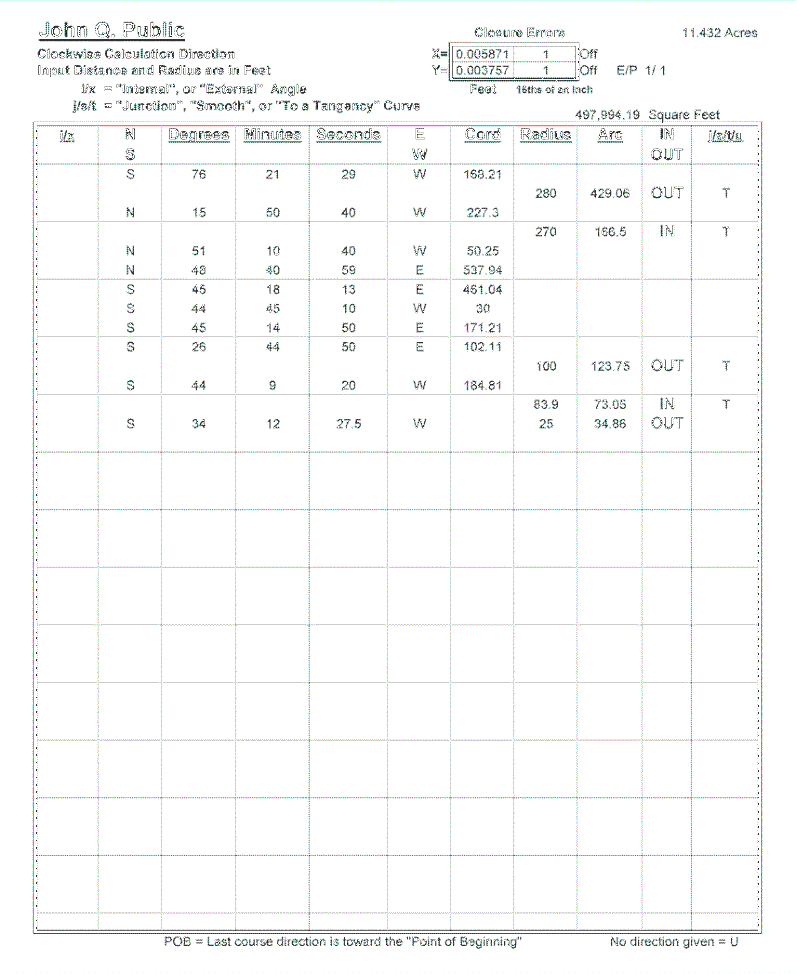
Here is an Example of our Basic Product. It's simply a graph of the property boundaries calculated from the "metes and bounds" supplied to LandPrints.
|
The second page confirms the input data used in the calculations and reports the amount of closure errors and plot area.
 |